Navigating America’s Most Scenic Drive
In 2020, people who were feeling confined at home sought safe ways to get out of the house. Escaping to park lands, both national, start and local, was a reprieve for many. Many of these folks found their way to the Blue Ridge Parkway, 14.1 million to be exact.
The 469-mile Blue Ridge Parkway which stretches from Virginia to the far-western reaches of North Carolina. Along the drive, pull outs, scenic overlooks and natural beauty are part of the appeal that brings these crowds to this roadway annually. The 45 miles-per-hour maximum is designed for drivers to take it slow and enjoy the views of the Appalachian Highlands. Bookended by the Great Smoky Mountains National Park on the southern end and the Shenandoah National Park on the northern end, the roadway takes travelers through one of the most biodiverse regions in the United States.
But, as anyone who has driven in the mountains knows, roads are not straight. The roads have uphill and downhill inclines, curves and narrowing roadbeds in places. This is true of the Blue Ridge Parkway. Taking your RV on the Blue Ridge Parkway is not the same as driving on the Interstate or multilane highways. The road was built in the 1930s during the Great Depression by federally-funded work crews.
But RVers are among the millions of visitors who navigate the roadway from end to end, or simply for one of the four sections – Ridge, Plateau, Highlands and Pisgah. There is some important information to keep in mind if the Blue Ridge Parkway is on your travel itinerary.
Tunnels could be problematic. Know the height of your RV, including anything that stick up from the roof, such as an air conditioner. It is important to know where the 26 tunnels are located and the height of your RV. Most of the tunnels are located after milepost 333.1, on the North Carolina section. A list of these and their clearance heights is available on the NPS website for the Blue Ridge Parkway (http://home.nps.gov/blri/planyourvisit/tunnel-heights.htm). Center heights vary, from 18.2 feet to 19.3 feet. Edge heights, however, are more of a challenge. The lowest edge measures 11 feet, with the majority of these about 13 feet.
By going slowly and following safety precautions, it is possible to pass safely through the tunnels. The National Park Service, which oversees the parkway, advises RV drivers to go through the tunnel in the center of the roadway, which offers the highest clearance, using the utmost caution. Oncoming traffic can be heavy in peak travel times and should be considered before driving down the center of the road.
Most of the tunnels with lower clearances are found on the southern end, which is an option for those who are hesitant to test their clearance. Easy access to other roads and highways allows motorists to continue their journey to Cherokee, North Carolina and the Great Smoky Mountains along alternative routes.
Remember you are in the mountains and there are hills to climb and descend. Using low gear saves the brakes, keeps your brakes from smoking and avoids that unmistakable bad odor of burning brake pads. You should shift to the lower gear before you start the downward trek.
Stopping frequently to allow the brakes to cool down is helpful, but a temporary solution when there are more uphill and downhill slopes to go. Another tip is to press the brake pedal intermittently. Keeping your foot on the brakes will cause overheating.
It is helpful to make sure your brakes are properly serviced and checked before embarking on a road trip that takes you through the mountains. A braking system malfunction when descending a steep grade is dangerous.
Common courtesy asks that if you are moving slowly and there are vehicles behind you, find a safe place to pull off and let the traffic pass you. The parkway is designed for leisure travel and pulling over at an overlook will settle your nerves, give you a breathtaking view and cool down your brakes.
Maintain a steady but safe speed. Given the size and weight of an RV, it is better to stay 10 miles under the posted limit. The lower speed will give the driver better control on the switchbacks or s-curves common on the parkway. When these curves occur during a downhill decent, it is harder to keep bigger rigs in the correct lane and on the road surface.
Weather conditions in the Blue Ridge mountains are another challenge. Foggy mornings are a given and it is cooler in higher elevations. During winter, portions of the parkway are closed due to snow and ice that make navigating that section hazardous. These closures when needed are marked and the visitor centers have this information to share with visitors.
Strong storms can also leave tree limbs and other debris scattered on the roads. Falling rock and the occasional mudslide may also make roads impassable. When these occur, the road is closed to traffic until the hazards are removed.
There is a reason that so many people are willing to face these challenges. Habitats found along the length of the Blue Ridge Parkway are diverse and, in many cases, rare. The views are scenic and exploring the trails and sites along the way get visitors in touch with wildlife, vegetation and history of the region.
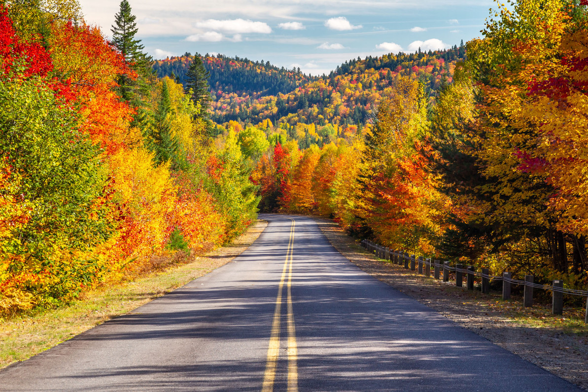
Fall is a favorite season when the slopes are bathed in vibrant hues, but the Blue Ridge Parkway is a fun drive no matter the season. Campgrounds are situated along the way, making a longer sightseeing trip a pleasant way to immerse yourself in a truly picturesque place.
Recent Posts
-
How to Keep Your Pets Safe While Camping
RVing and camping are a great getaway from the hustle and bustle of work and the city and the day-to …Jul 2nd 2024 -
Why Replace Your RV Furniture?
You may wonder when is the best time to replace your RV furniture. There is no one right answer to t …May 20th 2024 -
Can You Put Regular Furniture in an RV?
Many new and old RV owners ask themselves this question when they feel the need to update th …Apr 25th 2024 -
4 Tips for Securing RV Furniture While Traveling | RecPro
How To Secure RV Furniture There are few things that beat going out on an adventure with an RV …Apr 25th 2024 -
How To Keep RV Furniture From Peeling
Peeling RV Furniture | Why it Peels and How to Stop it Your RV furniture is a point of pride on yo …Apr 25th 2024 -
Turning up the Heat With an RV Fireplace
There’s an unlimited number of cool and exciting features you could add to your recreational vehicle …Apr 25th 2024


